GPX format, 1869 points, 255 Kb
Google Earth KML file, 1869 points, 53 Kb
 Back to Home Page
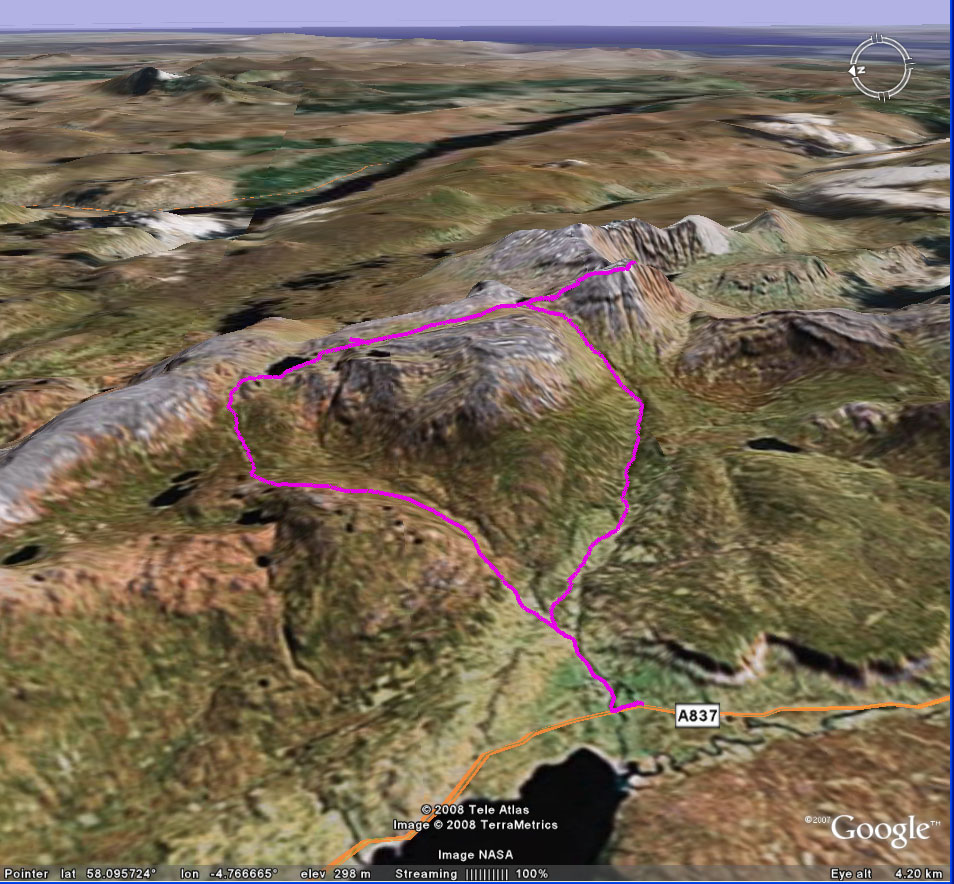
| Title Trip 29: Conival | Click on thumbnail for Google Earth snapshot:
|
| Date 16-17/08/2008 | |
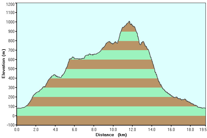
| Length 12.1 miles/ 19.5 km | |
| Start 1929 (16/08) Finish 1301 (17/08) | |
| Total time 17 hours 32 minutes (1 camp) | |
| Summits Conival (987m, M158) | |
|
Download trip 29 GPS data (track only) GPX format, 1869 points, 255 Kb Google Earth KML file, 1869 points, 53 Kb |