GPX format, 2041 points, 285 Kb
Google Earth KML file, 2041 points, 64 Kb
 Back to Home Page
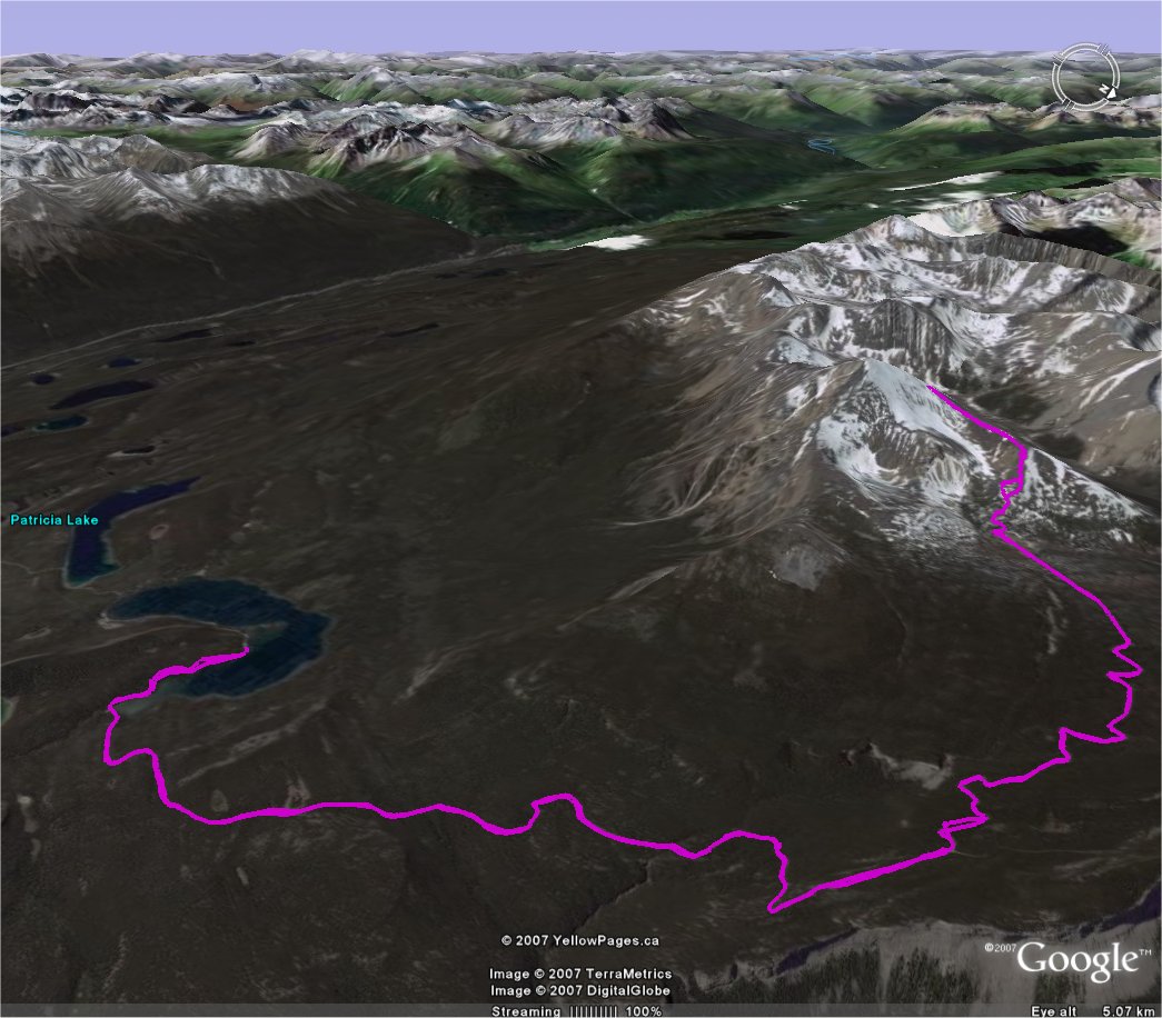
| Title Pyramid Mountain (Canada) | Click on thumbnail for Google Earth snapshot:
|
| Date 07/06/2007 | |
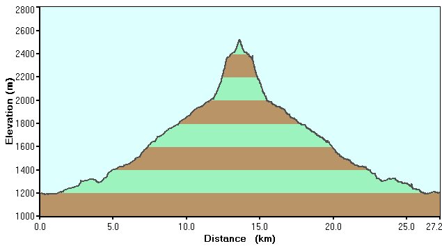
| Length 16.9 miles/ 27.2 km | |
| Start 0732 Finish 1818 | |
| Total time 10 hours 46 minutes | |
| Summits None (high point: 2530m) | |
|
Download Pyramid Mountain GPS data (track only) GPX format, 2041 points, 285 Kb Google Earth KML file, 2041 points, 64 Kb |