Crash date:
28/02/49
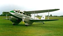
 [Picture from wikipedia.org] |
OS 10-figure grid ref (GPS): NT 18137 27760 |
This wreck site is about 300m east of the summit of Dollar Law, at an altitude of about 780m. It is about 6km north-east of the North American Harvard wreck on the nearby Broad Law (see my page about this wreck site here).
The site consists of one area of debris in small scar on a slope, with a few small pieces of wreckage, including sections of fuel tanks, metal spars and some wooden components.
The ACSS website has some information about the crash and photos of the site here. The PDAAR website has information and photos of the crash site here.
These pictures were taken in March 2016.
 |
 |
 |
 |
Wreck site location:
