 [Picture from wikipedia.org] |
OS 10-figure grid refs (GPS): NS 24027 54977 |
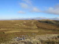
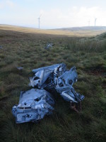
This wreck site is about 500m south-west of the summit of Blaeloch Hill in the Muirshiel Hills, at an altitude of about 400m. It is about 5km south-west of the Vickers Viking wreck on the nearby Irish Law and about 7km south of the de Havilland Devon and Vickers Wellington wrecks on Box Law (see my page about these wreck sites here). A wind farm has been built next to the site with an access road, making the area straightforward to visit.
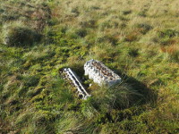
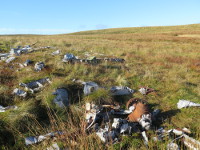
The site consists of one area of debris in and close to an impact crater, containing many parts, all of which are heavily damaged. The Rolls-Royce Griffon engine from the Firefly lies a few metres to the west of the main debris area partially buried in an area of marsh. The wreckage (especially the Griffon engine) can be compared to the Firefly wreckage on Lochnagar (see my page about this site here) and Meikle Bin (see my page about this site here).
The ACSS website has some information about the crash and photos of the site here. The PDAAR website has information and photos of the crash site here. A photograph on the NBSAB website here which was taken some time ago (probably in the 80s) shows the site as it used to be; there is more wreckage, the crash crater appears deeper and the blue paint mentioned on parts of the wreckage is no longer obvious.
These pictures were taken in October 2015.
 |
 |
 |
 |
